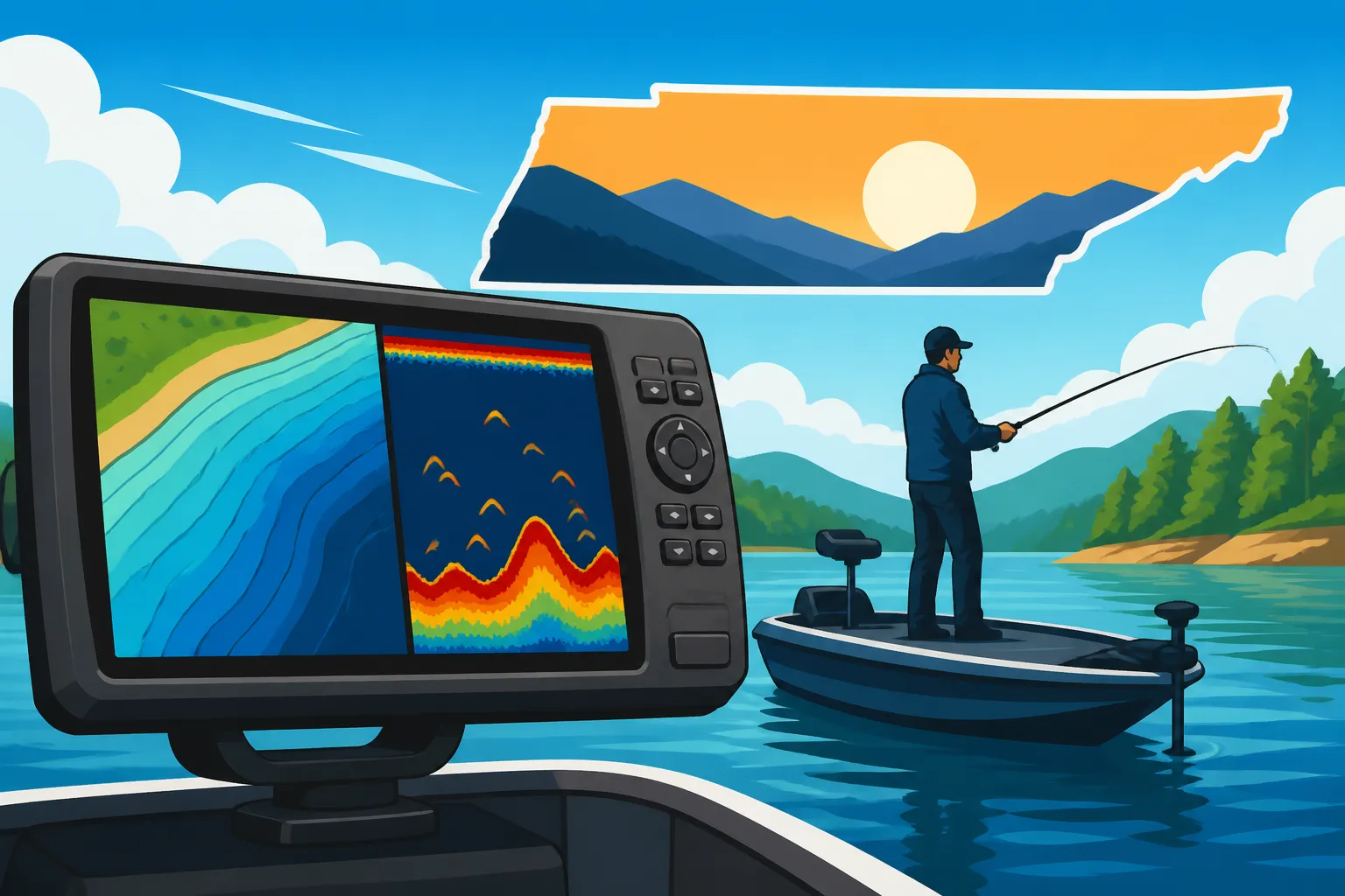
Best GPS Units for Lake Fishing
It’s a familiar frustration for many Tennessee anglers: you’ve spent hours researching the perfect fishing spot on a massive lake like Chickamauga or Kentucky Lake, you finally get out there, and then… you can’t seem to find that specific submerged hump, the subtle channel break, or that brush pile you heard so much about. Even worse, you found a hot spot, but now you can't get back to it! This guide is here to tackle that exact problem, helping you navigate the vast waters of Tennessee with confidence by exploring the best GPS units for lake fishing, ensuring you spend less time searching and more time reeling in your next big catch.
Why a Dedicated GPS is a Game-Changer on Tennessee Lakes
Let's be honest, our phones are amazing devices, capable of so much. They have maps, they tell us the weather, and they even take decent photos of our catches. But when you're out on the sprawling waters of Watts Bar Lake or trying to navigate the hidden coves of Norris Lake, relying solely on your phone for navigation can quickly turn into a headache, or worse, a safety concern. A dedicated GPS unit, however, is designed specifically for these challenging environments, offering a level of reliability and detail that your everyday smartphone just can't match.
Beyond Your Phone: Reliability and Durability
Think about it: your phone's battery is probably already stressed from social media, calls, and photos. Add constant GPS usage to that, and you'll find yourself scrambling for a charger before noon. Then there's the signal, or lack thereof. Ever been out on a remote section of Center Hill Lake and watched your phone's GPS simply give up, leaving you staring at a blank screen with no idea where you are? It's a genuinely unsettling feeling. Dedicated GPS units, especially those designed for marine use, have robust internal antennas that can often pull a signal where phones fail, ensuring you maintain navigational awareness no matter how far off the beaten path you go.
Beyond signal strength, durability is a huge factor. Phones are delicate creatures. One slip, one splash, and your navigational lifeline could be gone. Most dedicated lake fishing GPS units are built like tanks. They're typically waterproof, shock-resistant, and designed to withstand the harsh realities of a day on the water – from accidental drops to unexpected downpours. You won't have to baby it or worry about it conking out just when you need it most. This peace of mind is invaluable when you're focusing on the fishing, not on keeping your electronics dry. It truly lets you focus on the fishing experience, knowing your navigation is handled.
Unlocking Hidden Spots and Structure
This is where a dedicated GPS truly shines for serious anglers. Large Tennessee lakes are vast, complex ecosystems with countless underwater features that hold fish. We're talking about old riverbeds, submerged roadbeds, rock piles, humps, ledges, and deep channels. While you might stumble upon a few of these by chance, a GPS unit with detailed mapping is like having an X-ray vision for the lake bottom. It allows you to precisely locate these structures, mark them as waypoints, and return to them with pinpoint accuracy again and again.
Imagine you're trying to find that specific bend in the submerged river channel on Kentucky Lake where you know big bass like to ambush baitfish. With a detailed lake map on your GPS, you can see the contours, depth changes, and even old creek beds that might be invisible from the surface. You can mark a waypoint on a brush pile you discovered during a low-water period on Old Hickory Lake, and then return to it later in the year when crappie are stacked on it. These units transform the lake from a seemingly uniform expanse into a detailed, three-dimensional fishing playground. They give you the power to learn and master the underwater landscape, which is crucial for consistent success, especially when targeting specific species like bass or crappie that relate heavily to structure.
Key Features to Look for in a Lake Fishing GPS Unit
Choosing the right GPS unit can feel a bit like wading into a tackle shop full of shiny lures – there are so many options! But just like you pick a lure for a specific type of fishing, you'll want to select a GPS unit based on what features will serve you best on Tennessee's diverse lakes. Understanding the core functionalities will help you make an informed decision that enhances your time on the water.
Mapping Capabilities and Lake Data
The heart and soul of any good fishing GPS unit lies in its mapping. You need maps that aren't just pretty pictures but provide actual, usable data. Look for units that come pre-loaded with high-definition lake maps for Tennessee waters. This means detailed depth contours, often in 1-foot increments, allowing you to see subtle changes in bottom topography that could indicate a fish-holding structure. Relief shading, which visually represents depth changes, can be incredibly helpful for quickly identifying ledges or drop-offs.
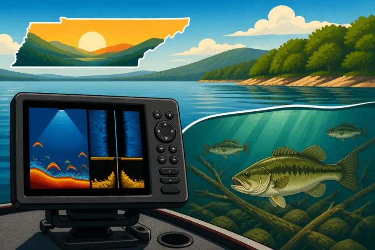
Some units offer advanced features like side-scan or down-imaging overlays, especially if you opt for an integrated fish finder combo. These can literally show you submerged trees or rock piles with photographic clarity. Before you buy, always check if the unit you're considering includes the specific Tennessee lakes you plan to fish most often. Sometimes, you might need to purchase additional map cards or subscriptions for even greater detail, but many good units will have excellent base maps. A unit with robust mapping can help you discover new productive areas and navigate safely, even in areas with tricky underwater features. For instance, knowing the exact depth changes on a vast lake like Watts Bar Lake, Tennessee's Largest Lake for Fishing can be the difference between a frustrating day and a successful one.
User Interface, Screen Size, and Portability
Imagine trying to program a waypoint or zoom in on a map while your boat is bouncing, your hands are wet, and the sun is glaring down. This is where a user-friendly interface and an appropriate screen size become paramount. Look for units with intuitive menus, large, easy-to-press buttons (or highly responsive touchscreens if you prefer), and a clear display that's readable in direct sunlight. A larger screen, while sometimes costing more or taking up more space, can make a huge difference in being able to quickly process information and make decisions on the water. No one wants to squint at a tiny display when there’s a schooling stripers frenzy happening.
Portability is another crucial consideration. Are you a bank angler who occasionally fishes from a small jon boat, or do you have a dedicated bass boat? Handheld units offer ultimate portability for Kayak Fishing Gear Checklist for Tennessee Rivers or wading in streams. Fixed-mount units, on the other hand, are permanently installed in your boat and often boast larger screens and more powerful features. Think about your primary fishing style and where you'll be using the GPS most often. If you fish different lakes from various vessels, a more portable option might suit you better, but if you're consistently on one boat on one of Tennessee's major reservoirs, a larger, fixed unit could be a better long-term investment.
Battery Life and Power Options
Nothing ruins a fishing trip faster than dead electronics. For any portable GPS unit, battery life is critical. Consider how long you typically spend on the water. Many handheld units run on standard AA batteries, while others have rechargeable internal batteries. Always check the manufacturer's stated battery life and consider carrying spare batteries or a portable power bank, especially for longer excursions.
For fixed-mount units in boats, you'll typically hardwire them into your boat's 12V electrical system. This means continuous power, which is fantastic, but you still need to ensure your boat's battery system is healthy and can handle the draw. Some smaller boat setups might benefit from an external, dedicated power supply for their GPS unit to avoid draining the starting battery. Always factor in the power requirements and how you'll manage them to avoid the dreaded "battery dead" screen halfway through your day on Percy Priest Lake.
Top GPS Units and Considerations for Tennessee Anglers
Now that we've covered the essential features, let's look at the types of GPS units you might encounter and some specific considerations for fishing Tennessee's diverse waters. The market offers a wide array of options, from simple handheld navigators to complex, multi-function display units that integrate nearly every piece of electronics on your boat. Knowing which category fits your angling style will simplify your search.
Handheld vs. Fixed-Mount Units
The first major decision often comes down to portability versus integration.
Handheld GPS Units:
These are fantastic for anglers who fish from various locations – a kayak one day, the bank the next, or wading a trout stream. They're compact, typically battery-powered, and easy to carry. Brands like Garmin and Lowrance offer excellent handheld units with pre-loaded maps and robust GPS accuracy. They're usually more affordable than fixed-mount units, making them a great entry point for anglers looking to add GPS capabilities without a major investment. The downside? Smaller screens, less processing power, and sometimes less detailed mapping unless you upgrade. They might not show you a full-screen, high-definition chart of Kentucky Lake Fishing on the Tennessee Side with every contour, but they will certainly get you to your marked waypoints.
Fixed-Mount Units:
These are designed for permanent installation in a boat. They typically feature larger screens, more powerful processors, and often integrate with other boat electronics. Many fixed-mount units are also fish finder/GPS combos, providing an all-in-one solution for navigation and fish detection. They draw power directly from your boat's battery, so you don't have to worry about battery life. These units are ideal for larger bass boats, pontoons, or deep-V boats that spend significant time on big reservoirs. The main drawbacks are the higher cost, the installation process, and the lack of portability if you fish from multiple platforms. However, for a dedicated boat angler, the benefits of a large, clear screen and seamless integration are undeniable.
Integrated Fish Finder/GPS Combos
For many serious anglers, the integrated fish finder/GPS combo unit is the ultimate solution. These devices combine a powerful GPS plotter with advanced sonar capabilities, offering a comprehensive view of what's below and where you're going. Instead of having two separate screens cluttering your dash, you get one unit that can display your map, traditional sonar, side imaging, down imaging, and even live sonar views all at once or in customizable split screens.
This integration is a huge advantage on Tennessee lakes. You can mark a brush pile you just spotted with your fish finder directly on your GPS map with a single button press. You can navigate to a specific depth contour using your map and then use your sonar to scan that depth for active fish. Best Fish Finders for Tennessee Lake Fishing often come with integrated GPS, making them incredibly versatile. Brands like Humminbird, Garmin, and Lowrance are leaders in this space, offering a wide range of models with varying levels of sophistication and price points. You can find a huge selection of these at retailers like Bass Pro Shops or online through Amazon, allowing you to compare features and read reviews before committing. The efficiency and comprehensive data provided by these combo units truly enhance your ability to find and catch fish more effectively.
Considering Your Budget and Future Needs
Let's talk brass tacks: price. GPS units for lake fishing can range from under a couple hundred dollars for a basic handheld model to several thousand for a top-of-the-line, large-screen, integrated multi-function display. Before you even start looking, set a realistic budget. Remember that sometimes spending a little more upfront for better features, mapping, or durability can save you frustration (and potentially more money) down the road.
Also, think about your "future needs." Are you a casual angler who just wants to mark a few spots and get back to the ramp safely? A simpler unit might be perfect. Or do you see yourself getting more serious, perhaps entering tournaments, or wanting to add more advanced sonar technology in the future? Some systems are more expandable than others, allowing you to add more transducers, network with other devices, or upgrade maps as your skills and budget grow. Investing in a system that can grow with you might seem like overkill now, but it could be a smart move if you anticipate becoming a more avid angler. Both Bass Pro Shops and Amazon offer a wide spectrum of products, from entry-level units to professional-grade equipment, so you're sure to find something that fits your needs and wallet.
Making the Most of Your GPS on Tennessee Lakes
Having a fancy GPS unit is one thing; truly maximizing its potential to enhance your fishing success on Tennessee's waters is another. It's not just about knowing where you are, but about leveraging the technology to become a more efficient and effective angler. From marking secret spots to ensuring your unit is always ready for action, a little knowledge goes a long way.
Marking Waypoints and Navigating Routes
This is arguably the most powerful feature of any fishing GPS unit. When you find a productive area – whether it's a stump field holding crappie, a rocky point where smallmouth are biting, or a thermocline that's stacked with baitfish – you need to mark it. A waypoint is simply a digital pin dropped on your map at that exact location. Give it a descriptive name (e.g., "Crappie Brush Pile 1," "Bass Ledge SW Corner," "Stripers Deep Drop") and maybe even add a note about the depth or time of year it was productive. This way, you can return to that spot next week, next month, or even next year with incredible accuracy. Imagine easily revisiting your favorite spot on Center Hill Lake Fishing Guide without having to re-learn the landscape.
Beyond individual spots, learn to create routes. A route is a series of connected waypoints that guide you from one point to another. This is invaluable for navigating safely through tricky channels, avoiding known hazards, or efficiently moving between a string of productive fishing spots. For example, you can create a route from the boat ramp on Boat Ramp Access on Tennessee's Major Lakes to your favorite trolling run for striped bass, ensuring you stay in safe water and hit all your key areas. Practice marking waypoints and creating simple routes on a calm day so you're comfortable with the process when the action heats up.
Regular Updates and Maintenance
Just like your phone or computer, your GPS unit's software and maps can get outdated. Manufacturers frequently release software updates that improve performance, add new features, and fix bugs. Similarly, map data can be updated to reflect changes in lake contours (especially in reservoirs where water levels fluctuate or new structures are added), or to provide even greater detail. Make it a habit to check for and install these updates periodically. Often, this can be done by connecting your unit to a computer via USB or, for newer units, via Wi-Fi. Running an outdated system might mean you're missing out on improved accuracy or critical new mapping information.
Maintenance is also key to longevity. After each outing, especially in saltwater (though most Tennessee fishing is freshwater, units can still get grimy), give your unit a quick wipe-down with a damp cloth to remove any water spots, dirt, or fish slime. Ensure all port covers are securely closed to prevent moisture intrusion. If your unit uses an external antenna, check its connections. For units with rechargeable batteries, follow the manufacturer's guidelines for charging and storage to maximize battery life over time. Proper care ensures your investment continues to perform reliably trip after trip.
Combining GPS with Other Navigational Tools
While a GPS unit is a powerful tool, it's never wise to rely on a single piece of equipment for navigation, especially on larger, complex bodies of water like those found in Tennessee. Think of your GPS as the primary guide, but always have backup strategies in mind.
Consider carrying a physical map of the lake, even if it's just a laminated chart. This can be a lifesaver if your electronics fail due to unforeseen issues like a power surge or total battery failure. Understanding local markers, buoys, and other navigational aids is also crucial. The Tennessee Wildlife Resources Agency (TWRA) marks many channels and hazards, and knowing what these markers mean will help you navigate safely regardless of what your screen shows. Using common sense, observing your surroundings, and staying aware of weather conditions, especially sudden changes that can bring fog or storms, are non-negotiable aspects of safe boating. By combining your GPS with traditional navigation skills and environmental awareness, you become a much more confident and capable angler on any Tennessee lake, from the vast expanse of Kentucky Lake to the winding rivers of the Cumberland.
| Feature | Handheld GPS Unit (e.g., Garmin eTrex Series) | Fixed-Mount GPS Plotter (e.g., Garmin ECHOMAP UHD) | Integrated Fish Finder/GPS Combo (e.g., Humminbird HELIX) |
|---|---|---|---|
| Typical Screen Size | 2-4 inches | 5-12+ inches | 5-15+ inches |
| Power Source | AA batteries / Internal rechargeable | Boat's 12V system | Boat's 12V system |
| Portability | Excellent (easily transferable) | None (fixed installation) | None (fixed installation) |
| Mapping Detail | Good, often requires upgrades | Very High, often pre-loaded | Very High, often pre-loaded with advanced features |
| Fish Finder | Rarely integrated | Optional add-on via networking | Fully integrated (sonar, side/down imaging) |
| Cost Range | Lower | Mid to High | Mid to Very High |
| Best For | Kayaks, bank fishing, wading, backup | Dedicated boat navigation, large screen | Dedicated boat fishing, comprehensive fish finding & nav |
| Ease of Installation | None | Moderate (wiring, mounting) | Moderate (transducer install, wiring, mounting) |
Disclaimer
This article is for general informational purposes only and does not constitute professional advice. Laws, prices and regulations vary by location and change over time. Consult a qualified professional for guidance on your specific situation.